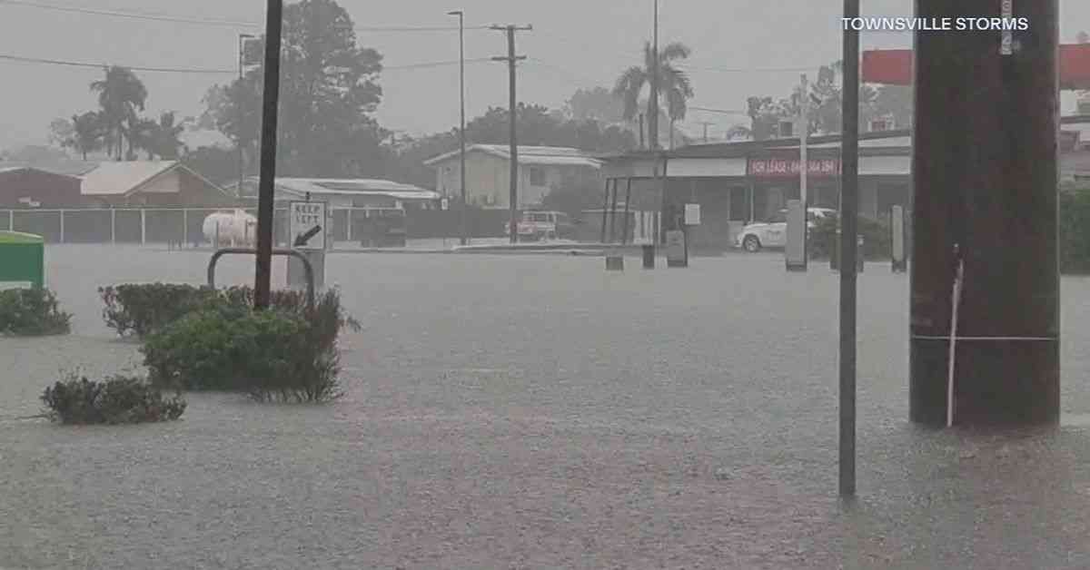
Northeast Queensland is currently grappling with intense floods and damaging winds, prompting multiple weather warnings across the region. A tropical low has caused parts of the region to be submerged in water, with Townsville bearing the brunt of excess rainfall of up to 200mm. The Ross River Dam has seen a significant swell of water moving through the spillway as part of its Emergency Action Plan. The situation has escalated to the point where crocodiles have been swept up in the floods, appearing in residential areas of Townsville.
Expanding Warnings and Evacuations
The emergency warning zone has been widened from Babinda down to the North of Townsville, with new flood warnings issued for Mourilyan and South Johnstone. Residents in these areas have been urged to evacuate immediately as more rain is forecasted, bringing the threat of intense floods. Concerns were raised about a woman who was swept away in floodwaters behind a shopping center in Townsville, but fortunately, she was found safe and well the following morning.
Rescue crews are on high alert, as the wet weather is expected to persist for the next three days. The Bureau of Meteorology cautioned about locally intense rainfall that could result in dangerous flash flooding, with further downpours of up to 1000mm anticipated over the weekend. The system also poses the risk of strong to damaging winds, with gusts reaching 90km/h for the islands and coastal stretch between Innisfail and Townsville.
Townsville’s disaster management teams have activated evacuation protocols, advising residents to prepare to leave their homes. Authorities have set up sandbag distribution points across various sites, and an evacuation center has been established at The Heatley Secondary College. In light of a report about an older woman being swept away after localized flooding, a search operation is currently underway in the vicinity of the Castletown shopping center to verify the situation.
Residents Brace for Impact
The severe weather conditions have prompted a warning to all Queensland residents to brace themselves for treacherous conditions amid widespread downpours. Shane Chelepy, Queensland’s State Disaster Coordinator, emphasized the impending nature of the event, labeling it as a significant rain and flooding episode. Chelsea Venz, a Cardwell resident, expressed her disbelief at the stark contrast between the Cassowary Coast Region and the Gold Coast, emphasizing the dramatic impact of being cut off by water.
The Bruce Highway faced closures north of Bowen, while other areas like Ingham also experienced temporary shutdowns due to flooding. Meteorologist Steven Hadley highlighted the likelihood of heavy and locally intense rainfall developing across the region, particularly between Cairns and Townsville, with the potential for severe impacts. The Johnstone River near Innisfail surged following the rainfall, and the Whitsundays saw over 180mm of precipitation, leading to the closure of Proserpine Airport.
The Bureau of Meteorology issued warnings about isolated heavy falls escalating into heavier and more widespread rainfall over the weekend. Forecasts predict over 1000mm of rainfall across the region, urging the community to stay informed about emergency warnings and alerts. Matt Collopy from the Bureau of Meteorology urged residents to be vigilant and understand the risks involved in the coming days, given the expected heavy to intense rainfall.
With six-hour rainfall totals ranging from 100-180mm and isolated totals peaking at 220mm, the situation remains precarious. The bureau is closely monitoring two tropical lows, one off the east coast and another in the Gulf of Carpentaria, both posing a low chance of developing into cyclones over the weekend. As the region prepares for the deluge, residents are advised to stay vigilant and heed all safety warnings to ensure their well-being.


